 DOWNHOLE TELEMETRY TOOLS
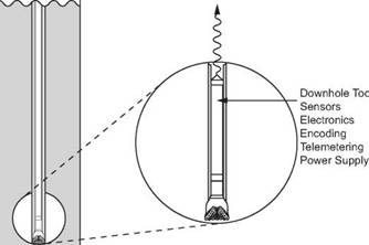
Surveying using photographic instruments is relatively simple and cheap (in terms of the cost of running the tools). There is however, the cost of the rig-time while the survey is being run. During this period the drillpipe will be stationary in the open hole at some point and there is therefore the possibility of the pipe becoming stuck. The longer the pipe remains stationary in the hole, the greater chance of getting stuck. To avoid stuck pipe some time is spent circulating to condition the hole prior to running the survey and the drillstring will be reciprocated whilst the survey tool is being run (or is dropping) down the drillstring. It is now possible to provide the directional driller with a real-time surface read-out (i. e. a system which will give him the survey data while the well is being drilled) from a measurement whilst Drilling (MWD) System (Figure 14). Although this involves more complicated tools, for which a higher rental cost will be incurred, it can be more cost-effective in the long run since it is not necessary to stop drilling whilst the survey tools are being run in and pulled from hole (approximately 2 hrs in a 10,000 ft well).
|
|
|
ж |
|
|
|
Signal Detection, Decoding, Scaling etc. |
|
Data Output to Storage, On-Site Recorders, Displays etc. |
|
Signal to Surface |
|
Figure 14 Telemetry Surveying Techniques |
MWD tools are discussed at length in chapter 13 but basically they consist of a downhole measuring unit built into a length of pipe which is similar to a drillcollar, a telemetry system and a surface read-out unit. Different telemetry methods may be used to transmit the information from downhole to surface. Some use a conducting wireline (steering tools) while others transmit signals through the mud column (MWD). The downhole measuring devices used may be gyroscopes, magnetometers or accelerometers. The disadvantage of gyroscopes is their tendency to drift off line and the risk of damage due to vibration during drilling. Magnetometers are more rugged instruments which measure the intensity and direction of the Earth’s magnetic field. An accelerometer measures the Earth’s gravitational field. Instead of taking photographs these instruments measure inclination and direction electronically and transmit results to the surface read-out unit. These tools are of great importance to the directional driller since they provide a great deal more directional information than the more discrete survey tools run on wireline. This extra data greatly assists the decisions-making regarding the course of the well.
